















UGVs and UAVs in Modern Armies and the PYRO Project
In modern armies, unmanned ground vehicles (UGVs) and unmanned aerial vehicles (UAVs) are playing an increasingly important role. While the first ground robots to be widely deployed were primarily remote-controlled vehicles for explosive ordnance disposal, today’s UGVs and UAVs cover a much broader range of tasks. Their capabilities range from simple remote control to systems with a high degree of autonomy. Engineers are striving to deploy these machines wherever the 3D rule applies (from the English “Dull, Dirty, Dangerous” – that is, monotonous, dirty, and dangerous work).
The main goal is to reduce the need to deploy soldiers to the highest-risk areas and to transfer some operations to unmanned systems – from reconnaissance and logistical support to direct combat operations. Machines do not experience fear or psychological trauma and can be deployed in toxic or otherwise hazardous environments. However, their capabilities are not unlimited: they are constrained by energy reserves, mechanical wear and tear, and the quality of data from onboard sensors. While cameras and lidars allow for operation at night and in conditions of reduced visibility, dense fog, smoke, dust, or rain can significantly reduce their accuracy. A human operator can move from an area under immediate threat to a safer location. This shift fundamentally changes the economics and logistics of warfare. The loss of a robot primarily represents material damage, or possibly the loss of sensitive technology or a unit’s capabilities. Unlike the loss of a trained specialist, however, it is generally easier to replace. The degree of autonomy varies significantly among individual systems. Some are controlled by an operator at all times, while others can independently follow a planned route, avoid obstacles, or analyze data from onboard sensors. Some weapon systems, once activated within a predefined area, can independently locate and engage a target based on specified criteria.
However, it is precisely this area that is the subject of intense legal, ethical, and security debate. Therefore, humans generally continue to define the mission, delineate the area and conditions of deployment, and oversee the system’s operations. The combination of human decision-making and machine endurance is particularly important in explosive ordnance survey operations. A robot can repeatedly and systematically search hazardous terrain, map suspicious locations, and carry sensors without directly endangering the life of a bomb disposal expert. The Czech PYRO project, which focuses on the automated reconnaissance of potentially mined areas, the detection of hazardous objects, and support for their subsequent disposal, also addresses this application of robotics.
Ukraine as a catalyst for military robotics
The war in Ukraine has become one of the most powerful catalysts for the development and widespread deployment of unmanned systems. In actual combat operations, the roles previously known for these systems have expanded significantly, and at the same time, a number of new tactical procedures have emerged.
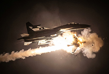
In the air, inexpensive FPV drones have proven effective; they can take out even heavy armored vehicles through precise strikes on vulnerable points or through repeated attacks. Alongside them operate heavy night-flying bomber drones, often nicknamed “Baba Yaga,” capable of carrying heavier payloads or multiple pieces of drop ammunition. Another category consists of specialized fighter drones, or interceptors, designed to destroy enemy reconnaissance and attack UAVs directly in the air.
On the ground, UGVs have begun to take over some of the most dangerous tasks on the very front lines, sometimes referred to as the “zero line.” Here, low-profile tracked or wheeled robots – operated remotely or using partial autonomous functions – transport ammunition and supplies so that soldiers do not have to repeatedly cross open terrain. They are also used as evacuation platforms equipped with stretchers, capable of transporting the wounded to a safer area under fire.
Developments have also led to offensive and defensive deployments. Some remotely controlled or partially autonomous machines are designed to rapidly lay mines in the area ahead of advancing enemy units, while others carry direct and indirect fire support systems. Other platforms can carry reconnaissance sensors, electronic warfare equipment, or weapon stations designed to guard selected sections of the front line.
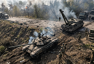

However, the widespread use of mines has simultaneously increased the need for their detection and clearance. Ukraine has become the country with the most extensive contamination by explosive ordnance in the world. In addition to minefields, its territory also contains unexploded artillery munitions, submunitions, and other explosive remnants of war. The war in Ukraine and other current conflicts demonstrate that minefields can be extensive, layered, and laced with traps that endanger even the deminers themselves. Clearing such affected areas using traditional methods will be a long-term and extremely dangerous task. Robotic systems therefore represent one of the key tools for surveying affected areas more quickly while also reducing the time that people must spend directly in hazardous zones. The actual demining, however, will continue to require a combination of robotic, mechanical, and manual methods.
From rats to artificial intelligence
According to the UN, more than 100 million people in over 60 countries and territories live under the threat of landmines and other explosive ordnance. Traditional demining is so slow that clearing the planet at the current pace would take decades. Efforts to speed up the process have led, among other things, to the training of giant African rats, which have an excellent sense of smell and are light enough that their movements usually do not trigger landmines. Deploying animals requires long-term training, care, and work within limited time frames. Robotic platforms can carry significantly heavier sensor equipment, but they are limited by battery capacity, terrain passability, and maintenance requirements.
Artificial intelligence and machine learning are becoming important tools for automated threat identification. In addition to hard-coded rules, neural networks can be trained on labeled sensor data sets – for example, on the magnetic signatures of known mines, test objects, and common metal debris. Algorithms search this data for recurring patterns that can help classify findings and reduce the number of false alarms.
Sensor fusion – the integration of data from magnetometers, cameras, and ground-penetrating radar – plays an important role in this process. Ground-penetrating radar can also help detect low-metal or plastic mines, but its effectiveness is influenced by soil type and moisture content, burial depth, surface topography, and surrounding interference.
Survival in the chaos of the modern battlefield
The battlefield is not only physically dangerous. It is also an extremely inhospitable environment in terms of navigation and communication. An adversary can jam signals from global satellite navigation systems, such as GPS, or interrupt radio communication between a machine and a human operator. It is precisely in these situations that the importance of a higher degree of autonomy becomes apparent. Advanced systems can have sufficient computing power onboard, so they do not need to rely on a data link with an operator or a GNSS signal at every step. If the connection is lost, they can use cameras, lidars, inertial navigation units, and other sensors to orient themselves based on their surroundings.
Another area of development – swarm robotics, or the collaboration of multiple aerial and ground vehicles – helps ensure mission success. UAVs can first create a map of the terrain and mark suspicious locations, while specialized ground robots conduct a more detailed reconnaissance of those areas. If one vehicle discovers a hazardous zone, it can share the information with the others, who will then adjust their planned routes or task assignments accordingly. This approach can speed up the reconnaissance of large areas while reducing the mission’s reliance on a single robot.
The UGV PYRO project
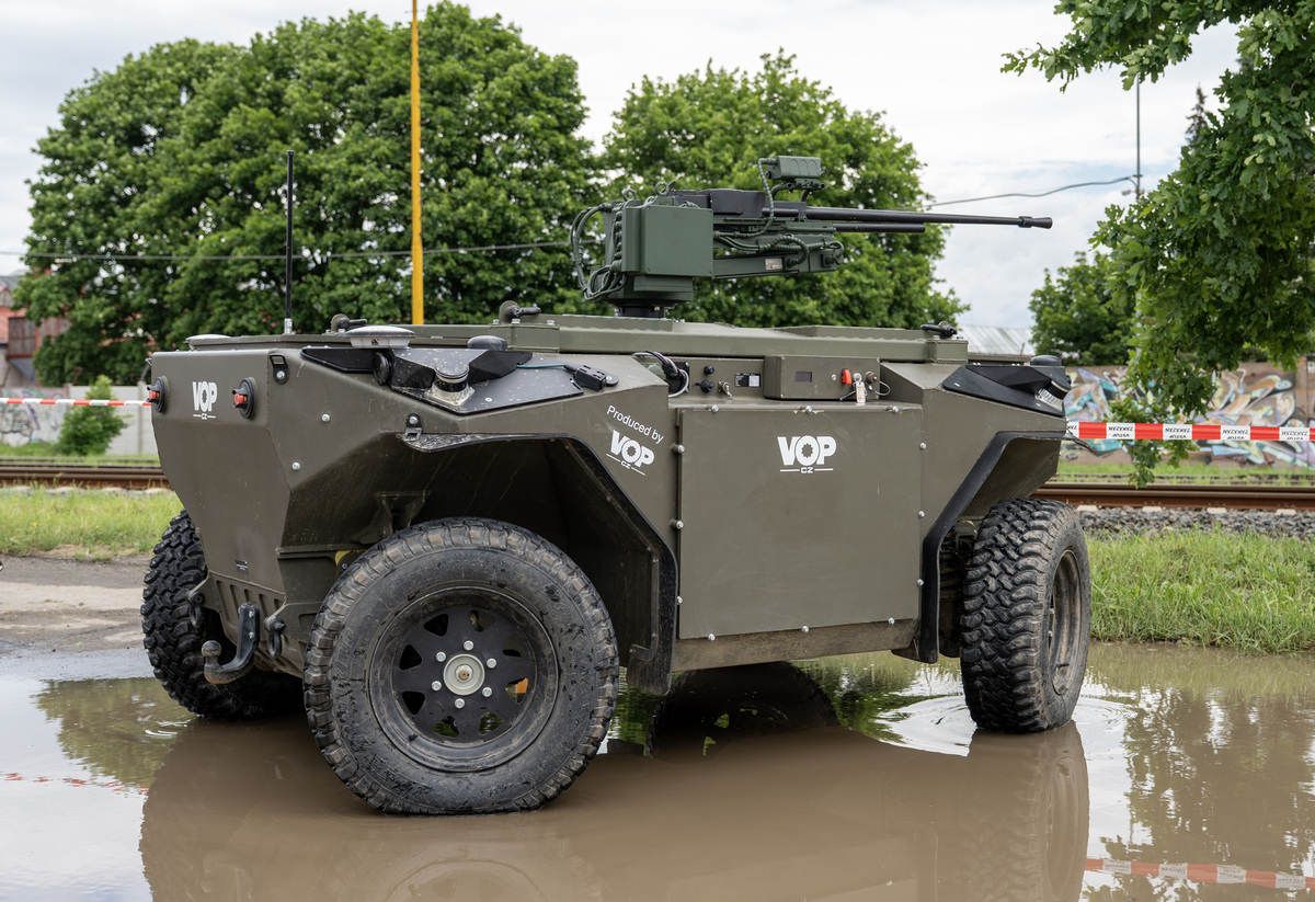
One specific advanced solution in the field of military robotics is a project by the Czech company VOP CZ in collaboration with the University of Defense and the Czech Technical University in Prague. The result is the UGV PYRO – an autonomous robot designed to search mined areas. To operate autonomously, the robot constantly analyzes its surroundings primarily using five 3D lidars and advanced navigation systems. Furthermore, its hardware platform is designed with a huge margin of capacity – it was engineered to be able to process data from up to twelve cameras simultaneously, if necessary. During the research, a wide variety of optical sensors – ranging from standard RGB cameras to thermal imaging and multispectral devices – could be alternately mounted on and tested with the robot. This potentially extreme data flow, which could total more than 20 gigabits per second, is processed by a powerful NVIDIA ORIN onboard computer.
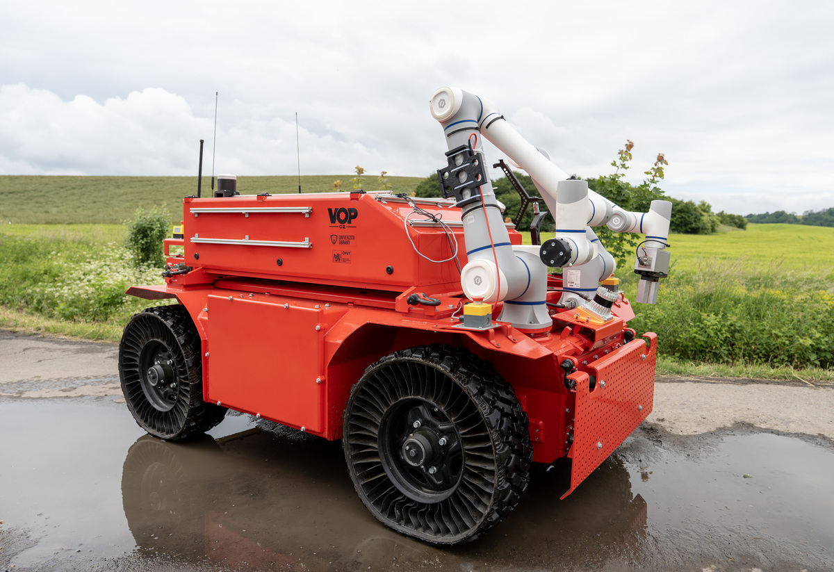
The UGV PYRO’s navigation in the field occurs on two levels. The global planner searches for the optimal route to search the area using algorithms inspired by ant behavior – it proposes a path that is both fast and energy-efficient. The actual control and obstacle avoidance are then handled by a local planner using the PhysX physics engine. In this virtual environment, the robot simulates traversing the terrain ahead of it 100 times per second to determine, even before physically moving, whether it is at risk of wheel slippage, getting stuck, or tipping over.
Autonomous threat identification
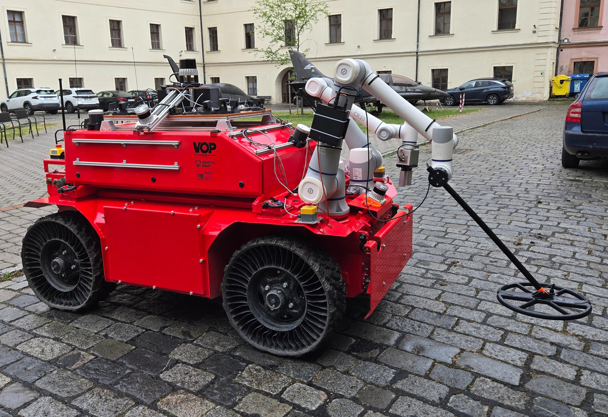
During its survey, the robot uses two front robotic arms equipped with the Minefinder DAQ detection system. The arm precisely traces the terrain, and advanced magnetometers generate a detailed 3D map of the magnetic field, since even a small metal component in a mine distorts the Earth’s magnetic field. The onboard artificial intelligence analyzes the data in real time. It can determine the type of object and its depth with a high degree of certainty, or identify harmless metal debris, thereby significantly reducing the number of false alarms.
Seamless cooperation among all these layers is key. If the magnetometer detects an anomaly, the system immediately notifies the local planner. The robot slows down, and its arm begins to carefully scan the area. If the AI assesses the finding as a threat, the robot marks it on its virtual map as a danger zone. The planner immediately recalculates the trajectory to safely bypass the epicenter of the anomaly. This information is also updated in the global map for further navigation. Furthermore, the entire architecture is algorithmically designed to share data with the entire swarm – thus, any other units operating in the area that communicate with the UGV PYRO will automatically avoid the detected threat as well.